🚨IMPORTANT INFORMATION🚨
🚨Homeowners and Buyers🚨

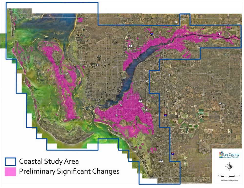
If you live or own property in the purple areas of this map, your plans to build/renovate or your National Flood Insurance (NFIP) policy premiums may be affected by these flood map changes.
This is a preliminary map, so it is not set in stone, BUT I would highly recommend contacting your insurance agent to determine if you may be affected!
In general, the map updates will result in one of the following for property owners in the affected area:
• You may be going into the Special Flood Hazard Area when you weren't before. The new flood map documents an increase in flood risk for your area (High risk flood zones: A, AE, AH, AO and VE)..you MAY receive a discounted rate if you lock in a rate prior to these changes going into affect.
• You may be coming out of the Special Flood Hazard Area. Moderate to low risk flood zones are named: X zone. Some may see removal from the SFHA as the elimination of any flood risk. But this is not the case. The new flood maps document a reduction in flood risk with the flood zone designation change, but the risk is not eliminated.
• The base flood elevation on your property may change (higher or lower). Flood Insurance policy premiums may be impacted.
For those properties with increases in flood risk, FEMA’s NFIP provides residents with cost-saving insurance rating options, such as grandfathering, to help reduce the financial impacts. For those properties no longer identified to be in high-risk areas, property owners will be encouraged to convert their existing flood policies to a lower-cost “Preferred Risk Policy” (or a PRP) with premiums starting at less than $200 a year. Contact your flood insurance agent for more information.
More info➡️ http://www.leegov.com/dcd/flood/floodways/femamapchanges


